

Sea Surface Temperature
Sea surface temperature (SST) monitoring involves using remote sensing technology and Geographic Information Systems (GIS) to measure and analyze sea surface temperatures.
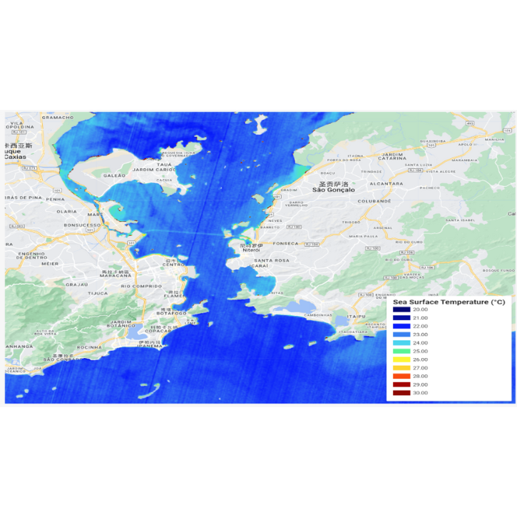
Description
Image Area: near Rio de Janeiro
Usage
Used to measure Sea Surface Temperature (SST), helping to monitor oceanic thermal patterns, track climate change, and study the effects on marine ecosystems;
Monitoring Frequency
Range from real-time or daily measurements for weather forecasting and climate studies to seasonal assessments for long-term environmental monitoring;
Significance
Essential for understanding climate dynamics, predicting weather patterns, supporting marine biology research, and managing fisheries and coastal resources.
contact us
-
Dubai headquarters
Address:
Units 610 & 611, Level 3, The Offices 3, One Central Dubai World Trade Centre, Dubai
Phone:
(+971) 04 594 3961
-
Hong Kong headquarters
Address:
15/F, Data Technology Hub, 5 Chun Cheong Street, Tseung Kwan O Industrial Estate, New Territories, Hong Kong
Phone:
(+852) 2161 8300
-
E-mail
ir@uspace.com


